
WES Portal - WES
Transportation & Infrastructure
Some of the key features include:
Data Integration and Management
Modeling and Simulation
Predictive Analytics & Machine Learning
Scenario Planning
Data Visualization and Reporting
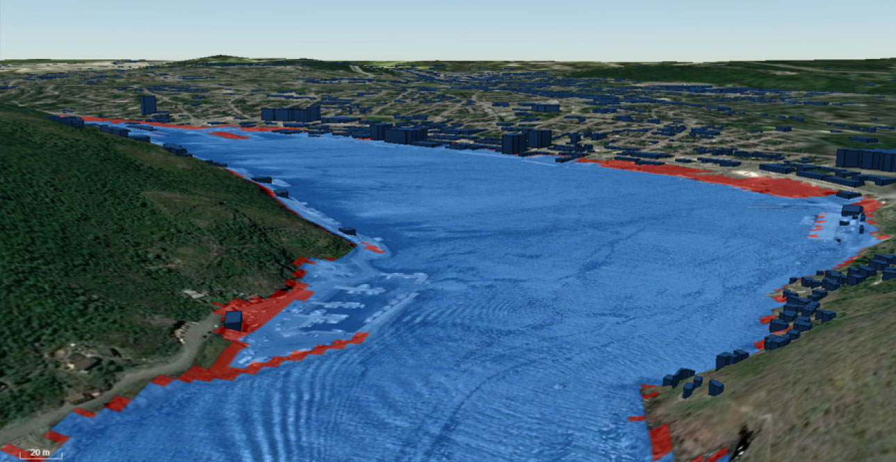
Sea Level Rise Modelling
Inland Flood Modelling and Response
For inland flood mapping, WES supports the integration of data from various sources to model water flow. Inland flood mapping utilizes shallow water equations; a set of hyperbolic partial differential equations used in fluid dynamics to model the flow of water from a lake or other inland source, enabling accurate flood prediction and management efforts.
Fire Prediction and Management
Arctic Ice Concentrations
Compusult's Web Enterprise Suite (WES) provides an integrated geospatial information management, infrastructure monitoring, operational intelligence, and decision-support platform that can help transportation agencies and infrastructure operators plan, manage, monitor, maintain, and protect critical transportation networks and infrastructure assets.
By integrating geographic information systems (GIS), satellite imagery, infrastructure asset data, transportation networks, IoT sensors, operational systems, AI-enabled analytics, and mobile field reporting, WES can establish a Common Operating Picture (COP) that supports transportation operations, infrastructure management, maintenance planning, risk assessment, and emergency response.
WES is applicable to transportation departments, highway authorities, airports, ports, rail operators, public transit agencies, infrastructure owners, municipalities, and government organizations.
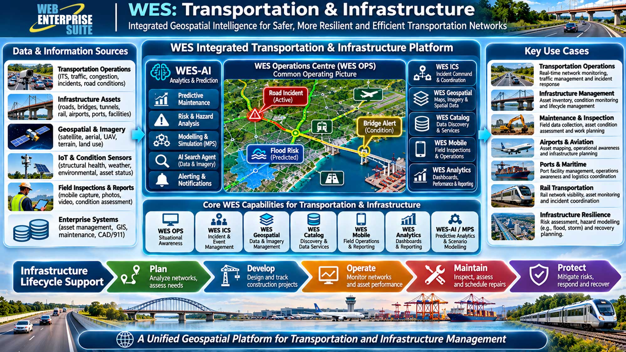
Key WES capabilities for transportation and infrastructure
1. Transportation Network Monitoring and Situational Awareness
- WES OPS provides a centralized, map-based Common Operating Picture that can integrate transportation networks, traffic information, infrastructure assets, incidents, and operational resources.
- Applications: Highway monitoring, road closures, congestion visualization, traffic incident coordination, and transportation network status.
2. Infrastructure Asset Management
- WES Geospatial, WES Catalog, and Meta Manager support the organization, discovery, management, and distribution of geospatial information and associated infrastructure datasets.
- Applications: Road and bridge inventories, rail networks, airports, ports, utility corridors, infrastructure condition records, and asset location mapping.
3. Infrastructure Condition Monitoring and Predictive Maintenance
- WES-AI and the Modelling & Predictive System (MPS) provide a framework for analyzing infrastructure condition information, inspection records, environmental factors, and sensor observations.
- With appropriate predictive models, WES could help identify deterioration trends, assess infrastructure risks, and prioritize maintenance activities.
- Applications: Bridge condition assessment, pavement deterioration analysis, infrastructure risk scoring, and predictive maintenance planning.
4. Mobile Infrastructure Inspection and Field Operations
- WES Mobile enables inspectors, engineers, maintenance crews, and field personnel to access geospatial information and submit georeferenced photographs, videos, observations, and inspection reports.
- Applications: Bridge inspections, roadway condition surveys, infrastructure damage assessments, maintenance reporting, and construction progress monitoring.
5. Transportation Planning and Geospatial Analysis
- WES can integrate terrain models, satellite imagery, land-use information, infrastructure networks, and environmental datasets to support transportation planning and infrastructure development.
- Applications: Transportation corridor analysis, route planning, infrastructure expansion, environmental impact assessment, and land-use compatibility analysis.
6. Transportation Incident Management and Infrastructure Resilience
- WES Emergency Management and WES ICS can support incident coordination, emergency resource tracking, operational awareness, and infrastructure recovery activities.
- Applications: Traffic accidents, bridge failures, flood-damaged roads, severe weather disruptions, hazardous material incidents, and infrastructure restoration.
7. Transportation Analytics and Performance Reporting
- WES Analytics, including WES Dashboard and Apache Superset integration, supports configurable dashboards, charts, statistical analysis, and reporting.
- Applications: Traffic trends, infrastructure condition indicators, maintenance performance, transportation network availability, incident statistics, and asset management reporting.
8. Multimodal Transportation and Logistics Coordination
- WES can integrate geospatial and operational information across road, rail, aviation, maritime, and logistics networks.
- Applications: Airport infrastructure monitoring, port operations awareness, rail corridor mapping, intermodal logistics coordination, and freight network visualization.
Other Industries
WES Operations Centre
WES Geospatial
Enterprise data warehouse for storing, managing, and delivering geospatial, imagery, and business data at scale.
WES Analytics
WES AI
WES Administration
Emergency Management & Incident Command
Aerospace & Defence
Geospatial intelligence, mission awareness and defence operations.
Environmental Monitoring & Mitigation
Maritime & Border Security
Transportation & Infrastructure
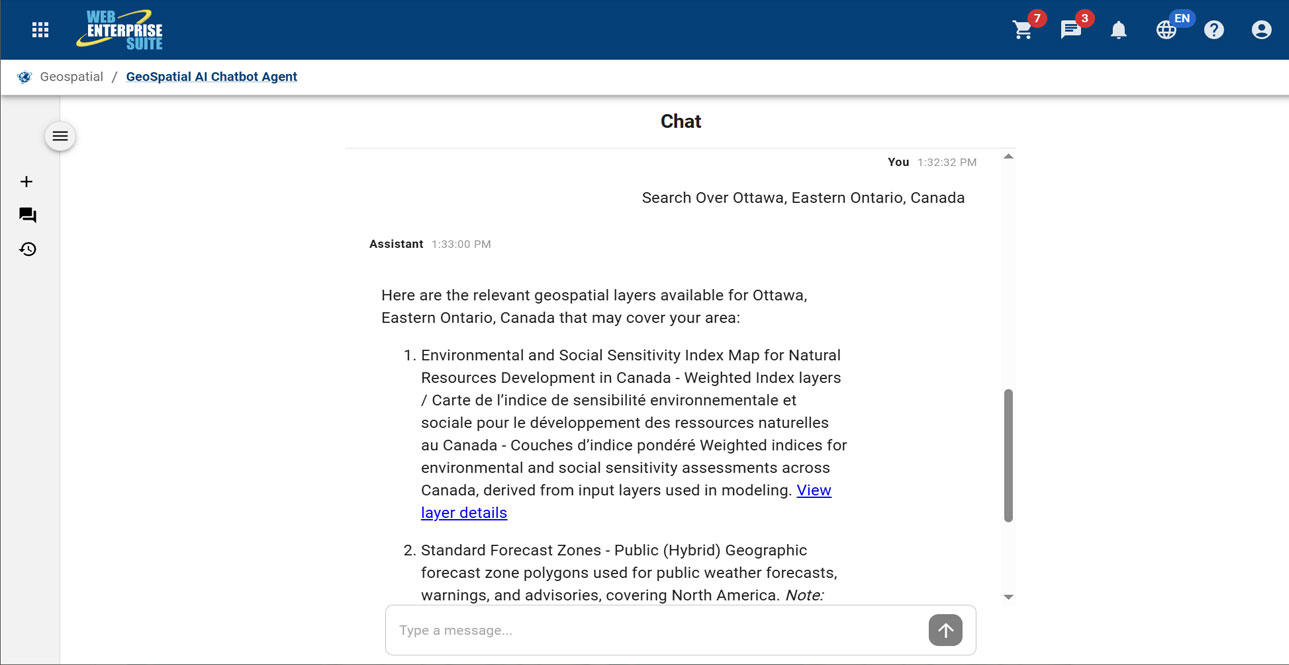
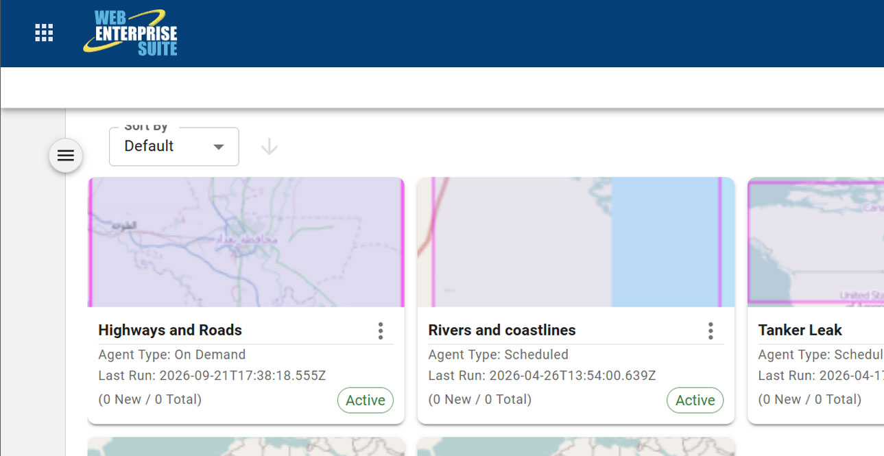
The AI modules/window components may be included within custom workflows and has been organized in the following broad categories:

Request a Live Demo
Access our demo site to use a sandbox version of WES.


