
WES Catalog Overview - Web Enterprise Suite
WES Catalog
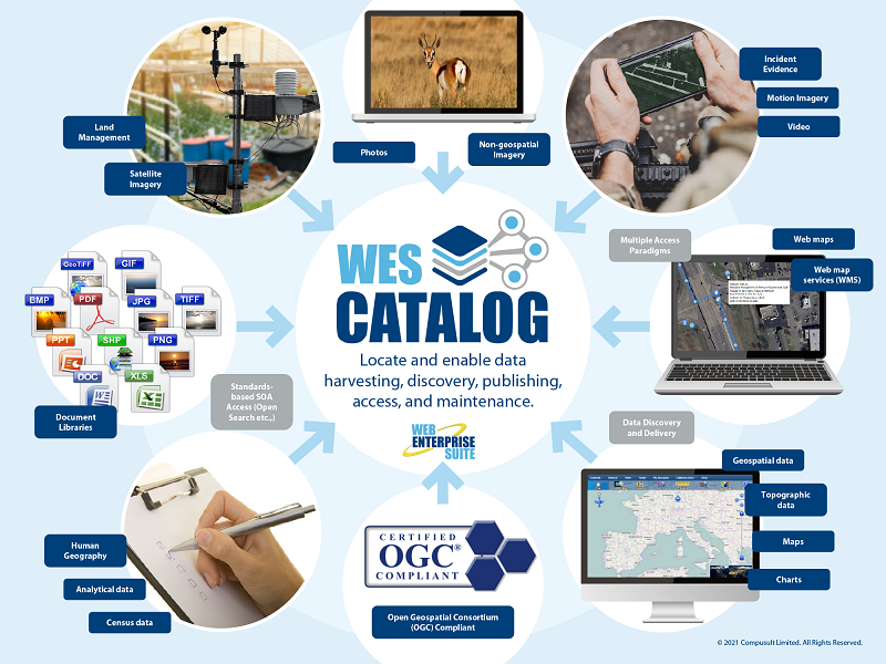
WES Catalog now makes it easy to publish and organize geospatial and related Web services, making it easier for users to discover and exploit resources within the enterprise. It implements a catalog, repository, and standard-based interfaces to publish and search for any type of geospatial/non-geospatial Web resources.
Whether integrating with existing spatial data infrastructures, searching for data, or building metadata-driven user interfaces, WES Catalog makes it easier to manage and advertise service data in a machine-readable way using an open standard, defined by the Open Geospatial Consortium (OGC).
WES Catalog has been implemented using the latest OGC standard, Catalog Service for the Web (CSW) 2.0.2 and is certified by the OGC.
The application has a configurable metadata harvest process that will automatically ingest service metadata from Web-services servers and clients.
Publish and Organize Data
Using OGC Standards
WES Catalog has sophisticated, yet easy to use publishing, search and browsing interfaces that provides organizations with the ability to manage and maximize usages of their Web services that are available through-out the enterprise. These interfaces have been implemented using and fully support many OGC standards associated with catalogs for the Web.
Client applications are able to query the Application Services metadata database to determine the services that are available for search and discovery, data selection and extraction and analysis.
Request a Live Demo
Access our demo site to use a sandbox version of WES.


