
WES Catalog Components - Web Enterprise Suite
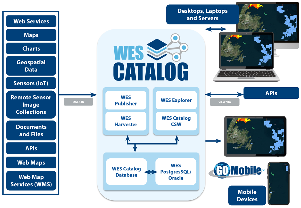
WES Catalog - Components
The key components of WES Catalog are made up of the following:
Allows users to publish and register geospatial applications, other services, styles, data and data products into the catalog. A publisher wizard is provided to lead users through the process of easily publishing Web resources that exist on the domain. All relevant metadata is extracted from the service endpoints and presented during the publishing process. Filtering and sorting options are provided for identifying services that may require services metadata updates.
WES Publisher is tightly integrated into GEO Network for metadata edits and entries.
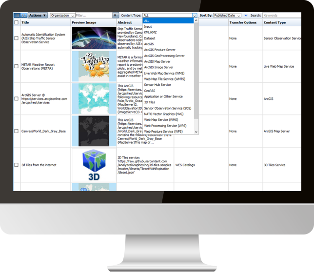
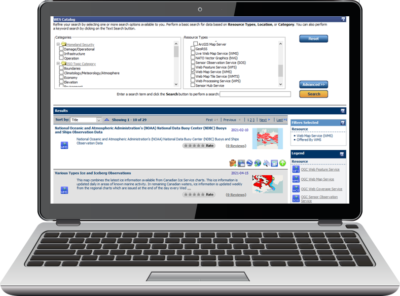
WES Explorer
Browse, View and Access Services
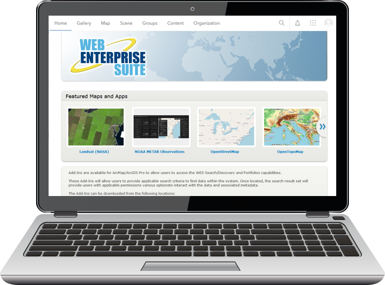
WES Explorer is an intuitive easy to use Web-based interface for browsing, viewing and accessing services and content maintained in WES Catalog. Organizations can easily connect WES Explorer into existing GEO Portals and geospatial mapping clients using the WES Explorer API.
Organizations can dynamically assign categories, resource types and any other hierarchical navigation trees to support browsing options. It supports creating situational views, provides users with the ability to rate a service and provides the status of resources published in the catalog.
WES Catalog Harvester
Extract Metadata
The harvester component of WES Catalog will connect to Web Services and those services that have capabilities XML documents and automatically extract metadata for inclusion into the WES Catalog.
The harvester can also be configured to automatically periodically harvest metadata for metadata updates as they occur.
Portal for ArcGIS Synchronization
Synchronization of Web Resources
Do more with Portal for ArcGIS when using WES Catalog and its synchronization capabilities. WES Catalog will automatically sync. services that are published in Portal for ArcGIS to WES Catalog and vice versa.
Once these services are synchronized into WES Catalog users are provided with the ability to augment metadata associated with the service and make corrections and updates as necessary.
Request a Live Demo
Access our demo site to use a sandbox version of WES.


