
WES Operations Center - WES

Your Mission. Your Common Operating Picture
One hub to monitor, coordinate, and manage critical operations
The WES OPS has been designed and implemented to enable:
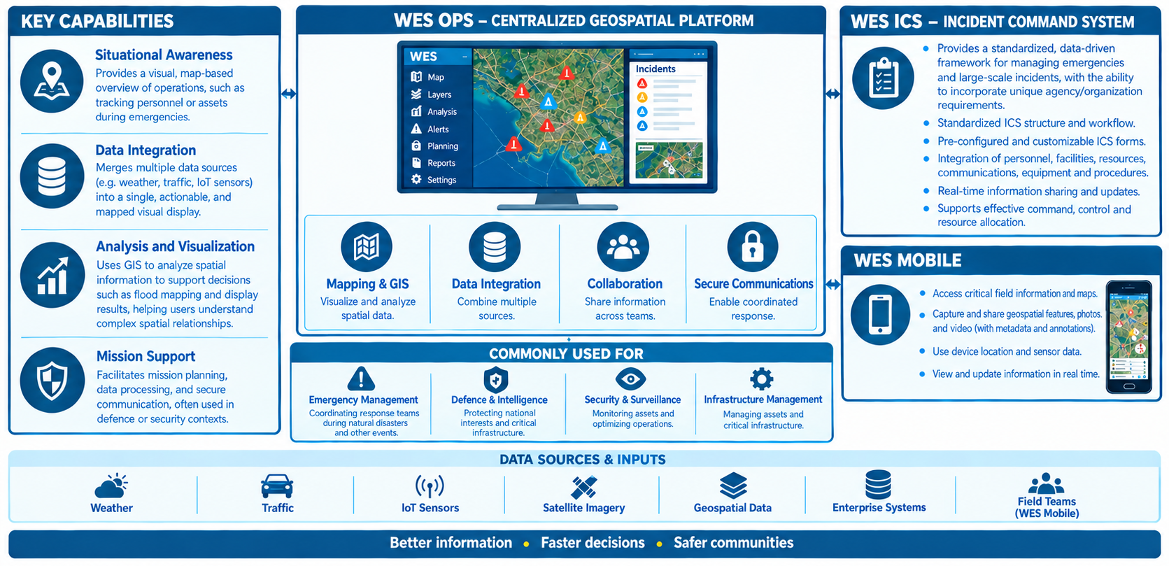
- Situational Awareness - Provides a visual, map-based overview of operations, such as tracking personnel or assets during emergencies.
- Data Integration - Merges multiple data sources (e.g., weather, traffic, IoT sensors) into a single, actionable, and mapped visual display.
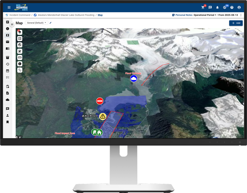
- Analysis and Visualization - Uses GIS to analyze spatial information to support functions such as flood mapping and display results, helping users understand complex spatial relationships.
- Mission Support: Facilitates mission planning, data processing, and secure communication, often used in defense or security contexts.
The WES OPS is commonly used to support:
- Emergency Management - Coordinating emergency response teams during natural disasters and other events.
- Defense & Intelligence - Providing actionable intelligence for national security.
- Security & Surveillance - Managing large-scale security operations.
- Infrastructure Management - Monitoring assets and optimizing logistics.
Designed and implemented to enable:
Situational Awareness
Data Integration
Analysis and Visualization
Mission Support
Commonly used to support:
Emergency Management
Defense & Intelligence
Security & Surveillance
Infrastructure Management
Components:




Uses OGC standards to provide first responders, surveyors and in-field data collectors with the ability to collect, consume and share information in connected or disconnected environments.

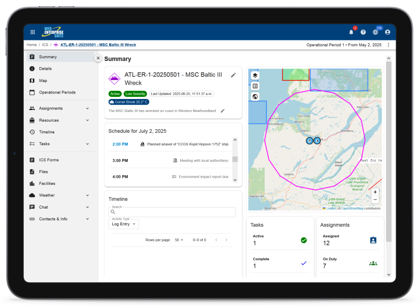
WES Incident Command System (WES ICS)
Provides a unique system that facilitates the capture and utilization of an agency’s and/or organization’s unique emergency response plans.
WES Mobile
WES Public Observations
WES Portal
A web portal environment integrated with open-source portal environments
WordPress
Drupal
Office 365/SharePoint/Azure
Liferay
WES Situational Awareness
A web mapping application that spatially fuses information, makes maps, discovers information and content
WES SensorHub
WES Geospatial
Meta Manager
WES Catalog
WES Components
The tools and applications have been organized into the following components that are provided to organizations utilizing the capabilities:
WES Operations Center

WES Geospatial
WES Analytics
WES AI
WES Administration
Request a Live Demo
Access our demo site to use a sandbox version of WES.


