
WES Portal - WES
Environmental Monitoring & Mitigation
Some of the key features include:
Data Integration and Management
Modeling and Simulation
Predictive Analytics & Machine Learning
Scenario Planning
Data Visualization and Reporting
Sea Level Rise Modelling
Inland Flood Modelling and Response
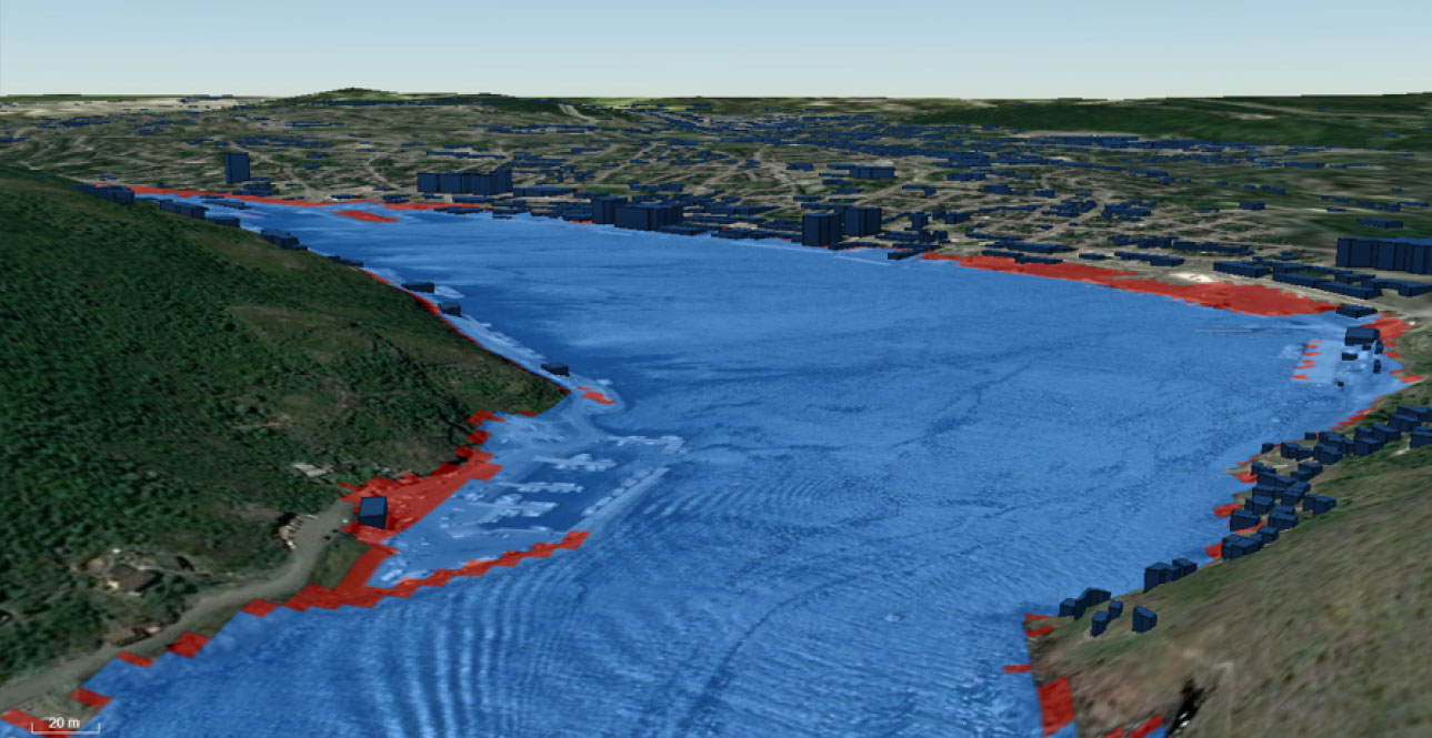
For inland flood mapping, WES supports the integration of data from various sources to model water flow. Inland flood mapping utilizes shallow water equations; a set of hyperbolic partial differential equations used in fluid dynamics to model the flow of water from a lake or other inland source, enabling accurate flood prediction and management efforts.
Fire Prediction and Management
Arctic Ice Concentrations
Compusult's Web Enterprise Suite (WES) provides an integrated geospatial information management, environmental intelligence, analytics, and operational decision-support platform that can help organizations monitor environmental conditions, assess risks, predict potential impacts, and coordinate mitigation and response activities.
By integrating satellite imagery, environmental sensors, climate datasets, geospatial information, predictive models, and field observations, WES can support a comprehensive approach to environmental monitoring, climate resilience, natural disaster preparedness, and environmental protection.
WES is particularly applicable to environmental protection agencies, natural resource departments, emergency management organizations, climate research institutions, coastal authorities, and national governments.
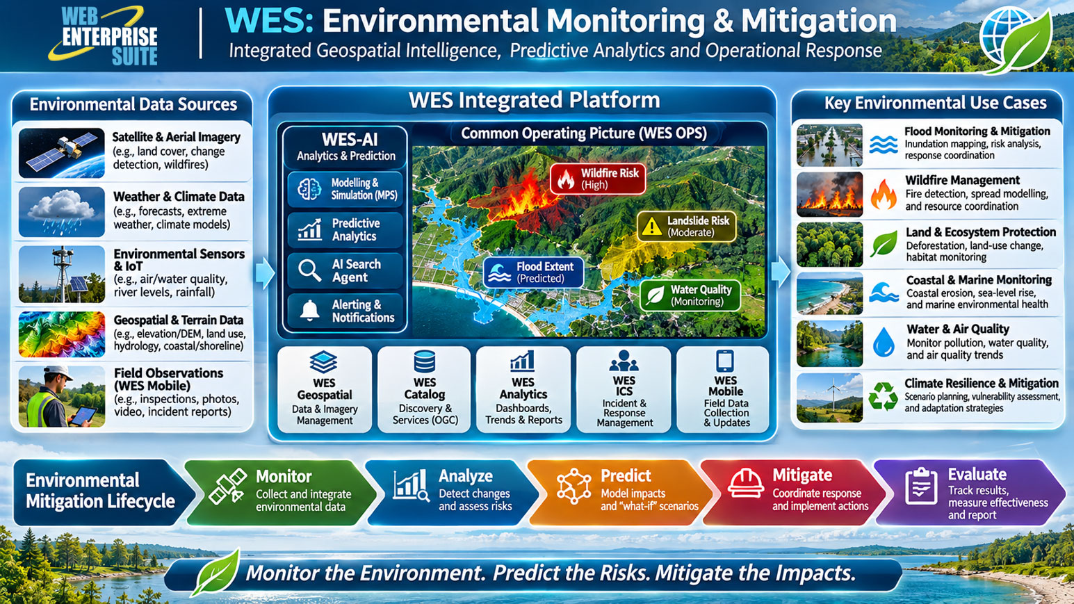
Key WES capabilities for environmental monitoring and mitigation.
1. Environmental Monitoring and Situational Awareness
- WES OPS provides a map-based Common Operating Picture (COP) that can integrate and display environmental conditions across geographic regions. It can bring together satellite imagery, sensor observations, weather data, hydrological information, and other environmental datasets to support monitoring of changing conditions.
- Applications: Flood monitoring, deforestation, coastal erosion, drought, wildfire activity, and land-use changes.
2. Climate Change Modelling and Predictive Analytics
- The WES-AI Modelling & Predictive System (MPS) provides a framework for integrating environmental datasets into multidimensional data cubes and applying modelling, simulation, and machine learning techniques.
- Applications: Sea-level rise, flood inundation modelling, extreme weather scenarios, wildfire risk, drought forecasting, and climate vulnerability assessments.
3. Environmental Sensor Integration and Data Collection
- WES can integrate information from environmental monitoring stations, IoT sensors, weather stations, water-quality monitoring systems, and remote sensing platforms through configured interfaces.
- Applications: Monitoring air and water quality, rainfall, river levels, temperature, soil moisture, and environmental hazards.
4. Geospatial Data Management and Environmental Intelligence
- WES Geospatial, WES Catalog, and Meta Manager support the storage, discovery, metadata management, and distribution of geospatial datasets and environmental information products.
- Applications: Satellite imagery repositories, environmental baseline mapping, habitat mapping, land-cover classification, and historical change analysis.
5. Mobile Environmental Field Data Collection
- WES Mobile enables environmental officers, inspectors, and field researchers to collect and transmit georeferenced observations, photographs, videos, and environmental incident reports.
- Applications: Pollution reporting, wildlife observations, environmental compliance inspections, coastal damage assessments, and post-disaster field surveys.
6. Environmental Incident Management and Mitigation
- WES Emergency Management and WES ICS can support environmental incident tracking, response coordination, resource management, and the implementation of mitigation activities.
- Applications: Flood response, wildfire coordination, oil spill management, hazardous material incidents, and environmental recovery operations.
7. Environmental Analytics, Reporting and Decision Support
- WES Analytics, including WES Dashboard and Apache Superset integration, provides configurable dashboards, charts, statistical summaries, and reports for analyzing environmental information.
- Applications: Environmental performance monitoring, trend analysis, regulatory reporting, mitigation effectiveness, and climate adaptation planning.
Other Industries
WES Operations Centre
WES Geospatial
Enterprise data warehouse for storing, managing, and delivering geospatial, imagery, and business data at scale.
WES Analytics
WES AI
WES Administration
Emergency Management & Incident Command
Aerospace & Defence
Geospatial intelligence, mission awareness and defence operations.
Environmental Monitoring & Mitigation
Maritime & Border Security
Transportation & Infrastructure
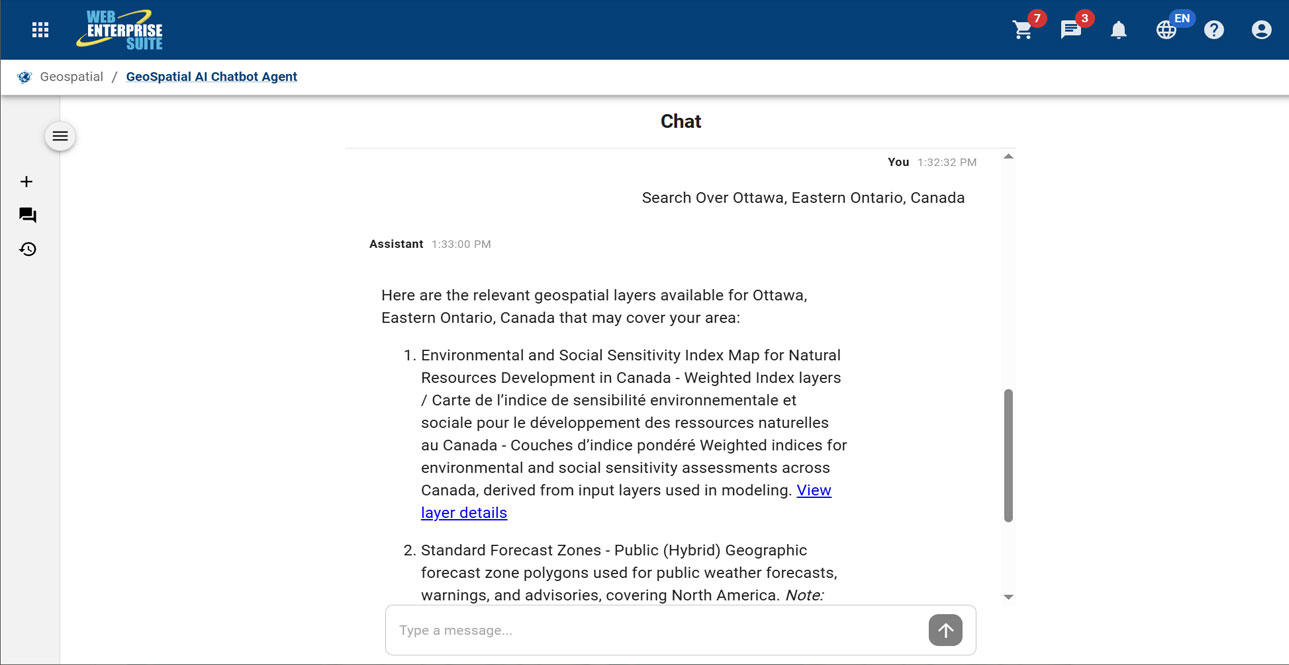
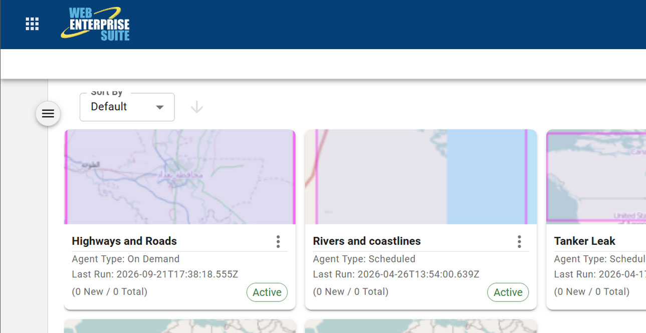
The AI modules/window components may be included within custom workflows and has been organized in the following broad categories:

Request a Live Demo
Access our demo site to use a sandbox version of WES.


