
WES Geospatial | Enterprise Geospatial Data Management - WES

Search, Discover, and Utilize Geospatial Information
WES Geospatial
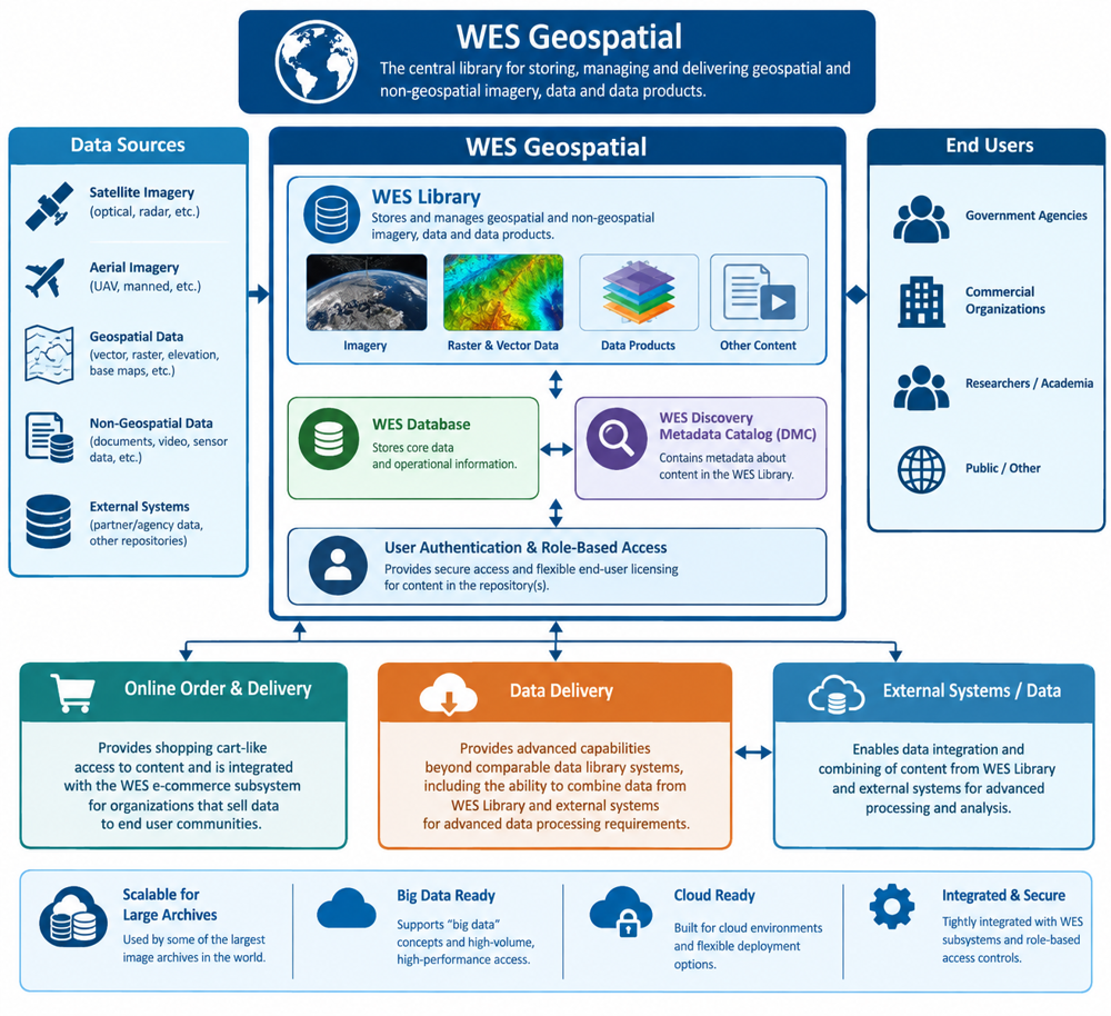
A data warehouse that provides ingestion, storage and delivery of geospatial, structured and unstructured data, supports big data concepts and is cloud ready. It provides a metadata capability that maintains transactions, such as users, orders and data/metadata ingestion.
WES Geospatial Search seamlessly provides:
- One Library and every Dataset for smarter Geospatial Discovery.
- The ability to make massive data archives to Instant, actionable insight.
- Consolidated search, discover and delivery utilizing an intelligent gateway to geospatial data.
- The ability to unlock your geospatial data securely, intelligently, and at scale.
- Where geospatial data becomes discoverable, accessible, and actionable.
Geospatial Library
and Data Management.
WES Geospatial Search acts as a library for the storage of geospatial/non-geospatial imagery, data and data products. This subsystem is being used by some of the largest image archives in the world, supports the "big data" concepts and is cloud ready.
WES Geospatial Search uses the WES database and the WES Discovery Metadata Catalog (DMC) to contain metadata about content stored in WES Library. It is tightly linked to the WES User Authentication and role-based access models that provides flexible end-user licensing for access to content in the repository(s).

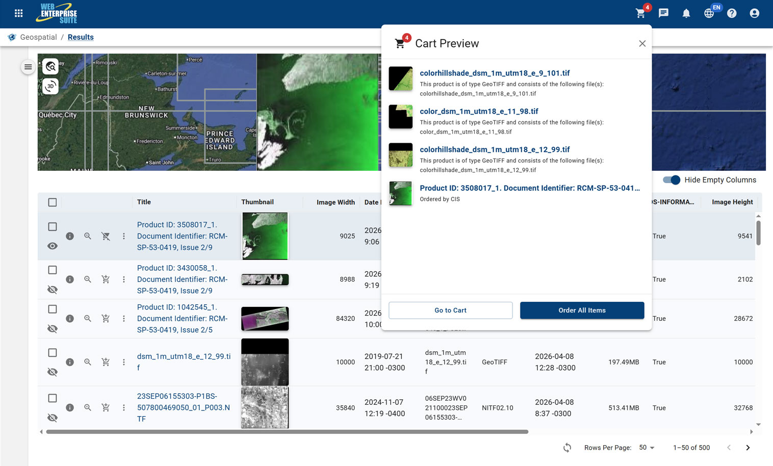
WES Online Data Ordering & Delivery.
The online order and delivery modules provide shopping cart-like access to content and are integrated into the e-commerce WES subsystem for organizations that sell data to end user communities.
The data delivery module provides additional capabilities above and beyond comparable data library systems, including the ability to combine data from WES Library and external systems for advanced data processing requirements.
Cloud Ready.
The Possibilities are Endless.
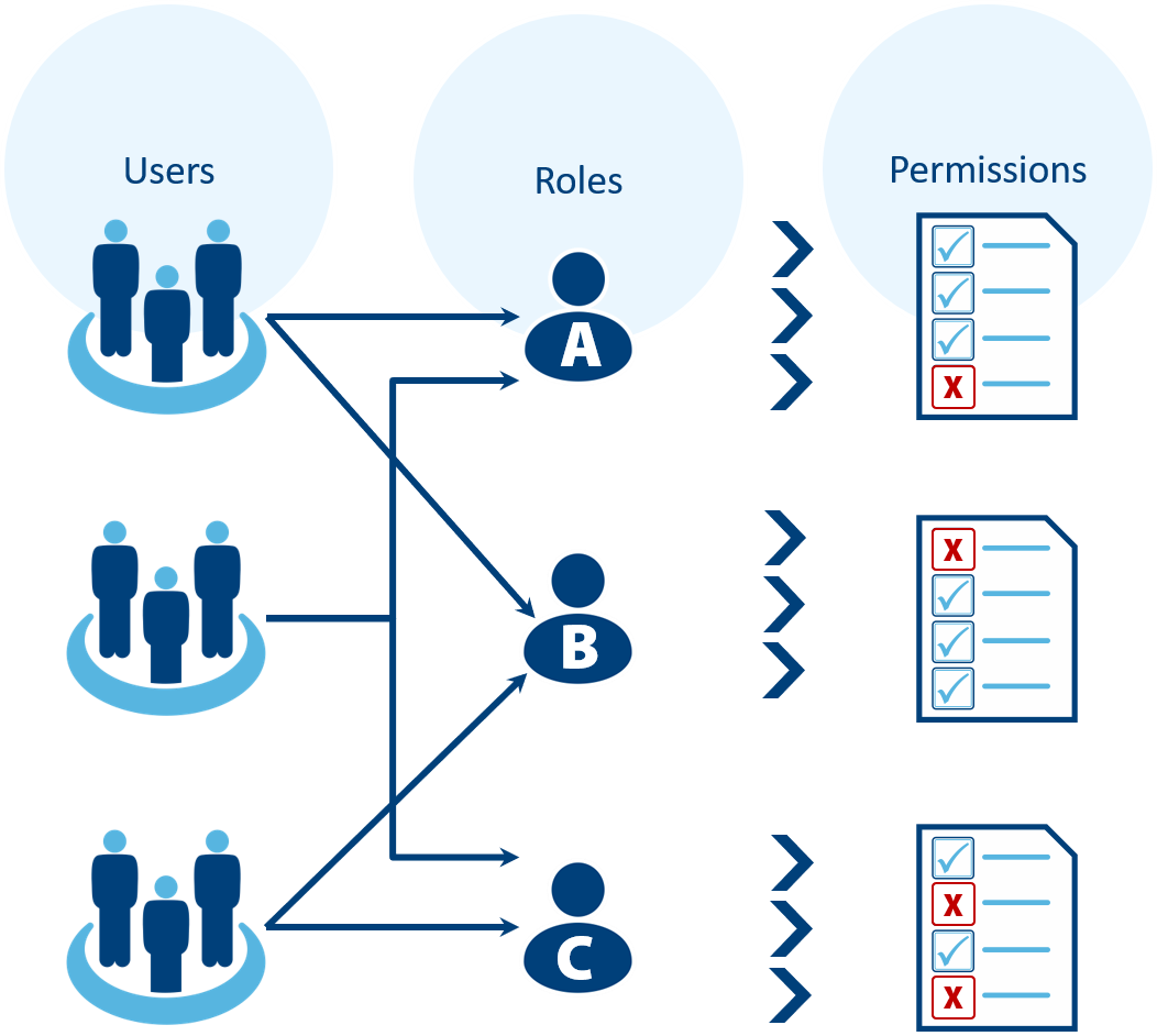
Role and user-based access controls provide secure access to an organizations data. This feature ensures that users are granted access only to the data and data products that they have been authorized to view.
Configurable Dashboards
for Discovery Analysis and Access.
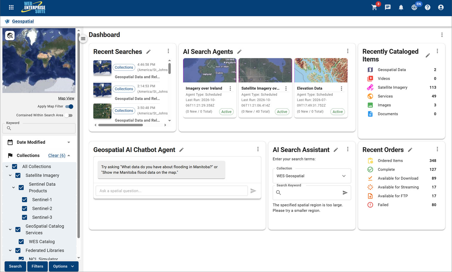
Landing pages such as the one illustrated above are system/user level configurable using the concept of window components (Widgets). This particular window was configured to support a more advanced geospatial analysis.
Examples of the WES Geospatial dashboard are contained below:
Map
Collections
Geospatial AI Chatbot Agent
AI Search Assistant
Status Window Components
AI Search Agents
Core Components for a More Capable Organization.
WES Components
The tools and applications have been organized into the following components that are provided to organizations utilizing the capabilities:
WES Operations Centre
WES Geospatial
Enterprise data warehouse for storing, managing, and delivering geospatial, imagery, and business data at scale.
WES Analytics
WES AI
WES Administration
WES Operations Center
WES Geospatial
WES Analytics
WES AI
WES Administration
Request a Live Demo
Access our demo site to use a sandbox version of WES.


