
WES GeoProject - WES
WES GeoProject
Geospatial Project Monitoring, Management & Performance Intelligence
Introducing WES GeoProject as a new component of Compusult's Web Enterprise Suite (WES).
WES GeoProject provides a centralized, map-based project management and monitoring environment designed specifically for organizations planning, executing, and overseeing geospatial projects.
Unlike conventional project management tools, WES GeoProject would combine project schedules, budgets, resources, deliverables, geographic coverage, field activities, and performance indicators into a single Geospatial Project Operating Picture.
It is particularly valuable for national mapping agencies, government departments, defence organizations, environmental agencies, infrastructure operators, and organizations managing large-scale geospatial data acquisition and mapping programs.
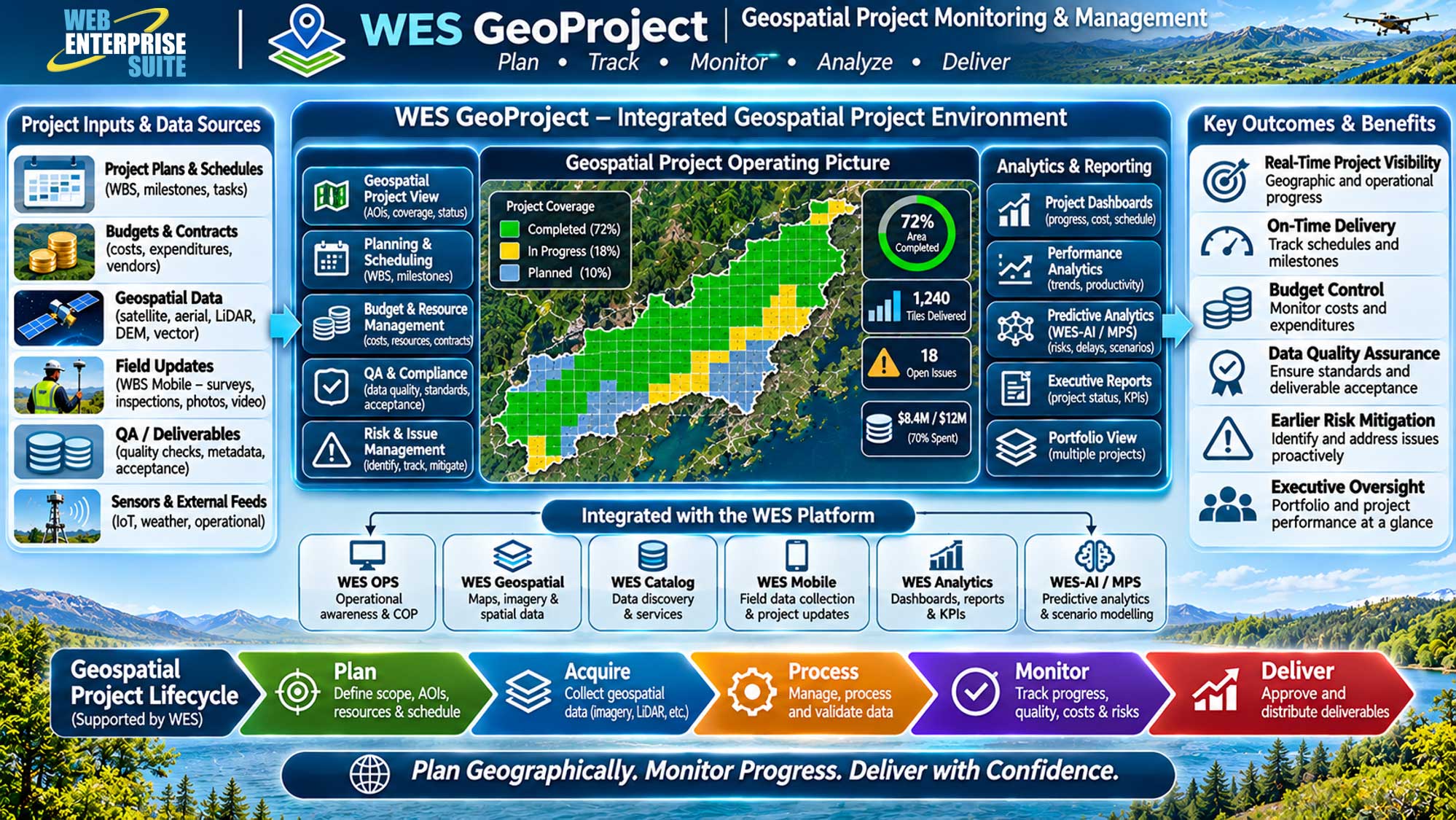
WES GeoProject capabilities:
1. Geospatial Project Monitoring
- Interactive maps showing project boundaries, areas of interest (AOIs), geographic coverage, project status, and completion percentages.
- Example: Monitor the progress of a national aerial imagery acquisition program by geographic region.
2. Project Planning and Scheduling
- Manage project work breakdown structures (WBS), milestones, schedules, dependencies, task assignments, and planned versus actual completion.
- Example: Track satellite imagery acquisition, processing, quality assurance, and delivery milestones.
3. Geospatial Data Acquisition and Deliverable Tracking
- Monitor the acquisition, processing, validation, approval, and delivery of geospatial datasets, including satellite imagery, aerial photography, LiDAR, elevation models, and vector mapping.
- Example: Track completed and outstanding LiDAR acquisition tiles across a province.
4. Budget, Cost and Resource Management
- Track project budgets, expenditures, contracts, resource assignments, and cost performance.
- Example: Compare budgeted and actual costs for a multi-year national mapping initiative.
5. Geospatial Quality Assurance and Compliance
- Monitor data completeness, positional accuracy, metadata quality, standards compliance, and deliverable acceptance.
- Example: Validate imagery resolution, geographic coverage, metadata completeness, and acceptance criteria.
6. AI-Enabled Project Risk and Performance Analysis
- Integrate WES-AI to identify schedule risks, potential cost overruns, data quality problems, and geographic coverage gaps.
- Example: Forecast whether adverse weather and aircraft availability could delay an aerial imagery acquisition project.
7. Field Operations and Project Reporting
- Integrate WES Mobile to allow surveyors, contractors, and field personnel to update project activities, report issues, and submit georeferenced photographs and observations.
- Example: Field survey teams report completed survey locations directly to the project dashboard.
8. Portfolio Management and Executive Reporting
- Provide a portfolio-level view of multiple geospatial projects, including progress, expenditures, risks, deliverables, and overall performance.
- Example: A national mapping agency monitors 30 concurrent geospatial projects from a single executive dashboard.
WES Components
The tools and applications have been organized into the following components that are provided to organizations utilizing the capabilities:
WES Operations Centre
WES Geospatial
Enterprise data warehouse for storing, managing, and delivering geospatial, imagery, and business data at scale.
WES Analytics
WES AI
WES Administration
WES Operations Centre
WES Geospatial
WES Analytics
WES AI
WES Administration
The AI modules/window components may be included within custom workflows and has been organized in the following broad categories:
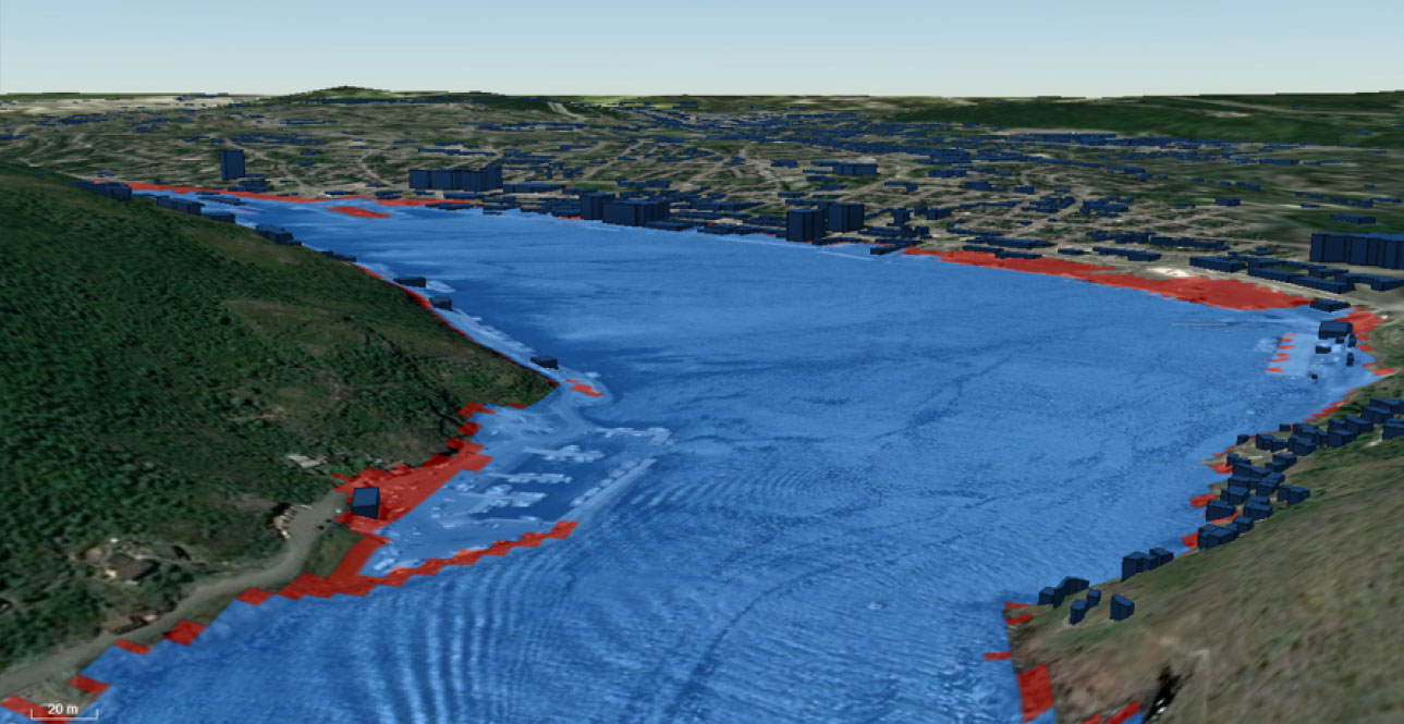
Modelling and Predictive System (MPS)
The evidence supporting climate change and the related effects due to human activities is now overwhelming and compelling.

AI Alerting
An AI application make decisions on behalf of and in support of users and the associated stakeholders.
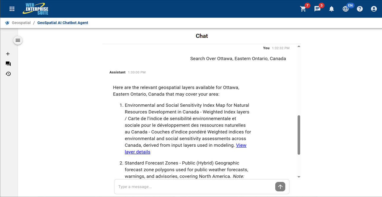
Geospatial AI Chatbot
A microservices-based generative AI chatbot prototype with natural language processing capabilities to handle discovery of relevant information and content on behalf of a user.
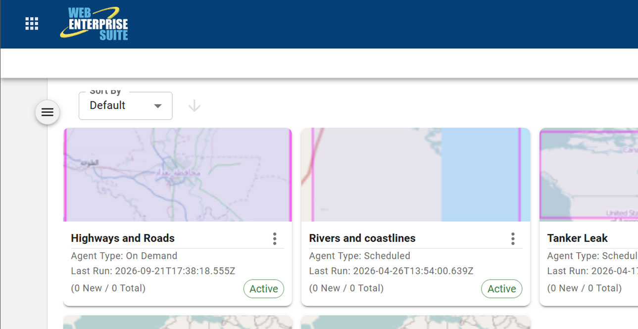
AI Search Agent
A powerful tool that enables the system to do the work on behalf of a user.
Request a Live Demo
Access our demo site to use a sandbox version of WES.


