
WES - Web Enterprise Suite
Publish and organize geospatial and non-geospatial data, making it easier for users to discover
Managing and Organizing Structured and Unstructured Metadata/Content Using Open Standards
Web Enterprise Suite
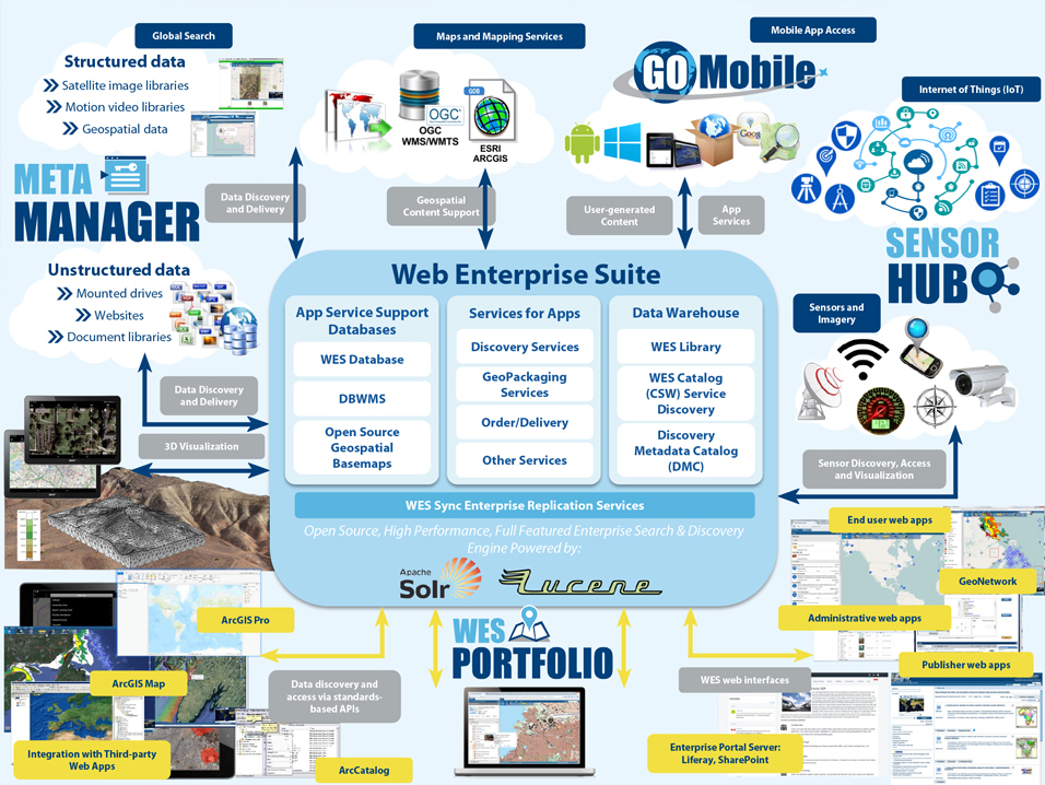
Web Enterprise Suite (WES) manages your geospatial data by delivering a complete, end-to-end system providing geospatial interoperability, publishing, data discovery, data management, data access/collection, data analysis/synchronization, user management and collaboration.
Utilizing Geospatial Tools. For Decision Support.
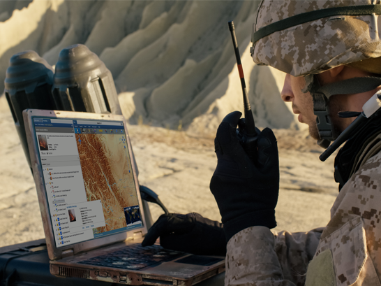
WES is based upon the utilization of geospatial tools and technologies combined with the incorporation of international standards to provide users with situational awareness to support the decision-making process. It provides an enterprise level data acquisition/management platform that delivers true situational awareness. From capture of vital information associated with first responders, field/survey and military personal to integrating Internet of Things (IoT) devices and sensors to the sophisticated management of all your geospatial data resources regardless of the format, WES is the leading geospatial platform that delivers.
Contact Us >>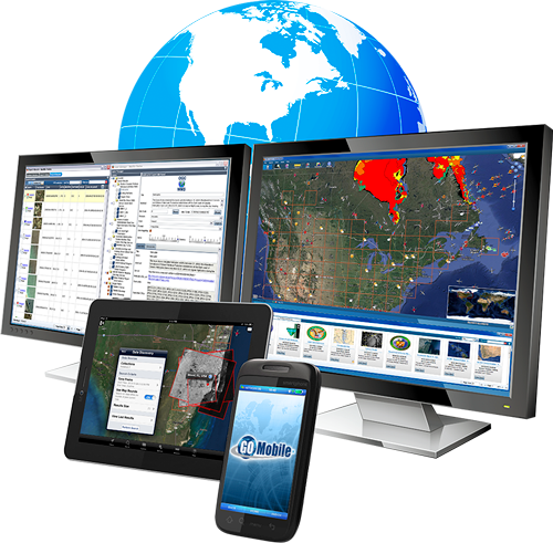
Providing the Right Information. At the Right Time.
The vision is to provide an environment where users and decision makers have the capability to discover, view, assemble, analyse, understand and share geospatial information, products and services for a particular area of interest, mission, incident and/or event, without needing to know the details of how the data and services are stored and maintained. Providing true transparent access. Users and decision makers are provided access to easily share information through a common, digital, geospatially referenced portal to enhance the decision-making process, information management, exploitation, manipulation, storage and dissemination.
Web Enterprise Suite. The Total Geospatial Solution.
Manage and understand your complex geospatial and non-geospatial data using WES for maximum productivity and resilience in an ever-changing challenging world. Strategic information gathering and secure profile access is combined with intuitive user and content interfaces delivering comprehensive knowledge and awareness.
Contact us for more details.
WES Companion Products
The items below can be purchased together or separately from Web Enterprise Suite.
SensorHub
An OGC-Compliant data acquisition system that provides the rapid integration of information from diverse sources such as cameras, and IoT sensors and devices. It is of particular value for first responders in emergency and disaster scenarios and for tasking sensors, creating alerts, and creating task chains.
Learn More
GO Mobile
An Android and Windows-based mobile application that uses OGC standards to provide first responders, surveyors, and in-field data collectors with the ability to collect, consume, and share information in connected or disconnected environments.
Learn More
Meta Manager
An automated, easy-to-use publishing and discovery metadata management service for geospatial, structured and unstructured, data using OGC, ISO and other metadata standards. It allows users to create and search standardized metadata from database repositories or file-based data.
Learn MoreRequest a Live Demo
Access our demo site and play around with a sandbox version of WES.


