
WES Mobile - GIS Mobile Software - WES

A mobile application, available for Android and iOS platforms
Uses OGC standards to provide first responders, surveyors and in-field data collectors with the ability to collect, consume and share information in connected or disconnected environments.
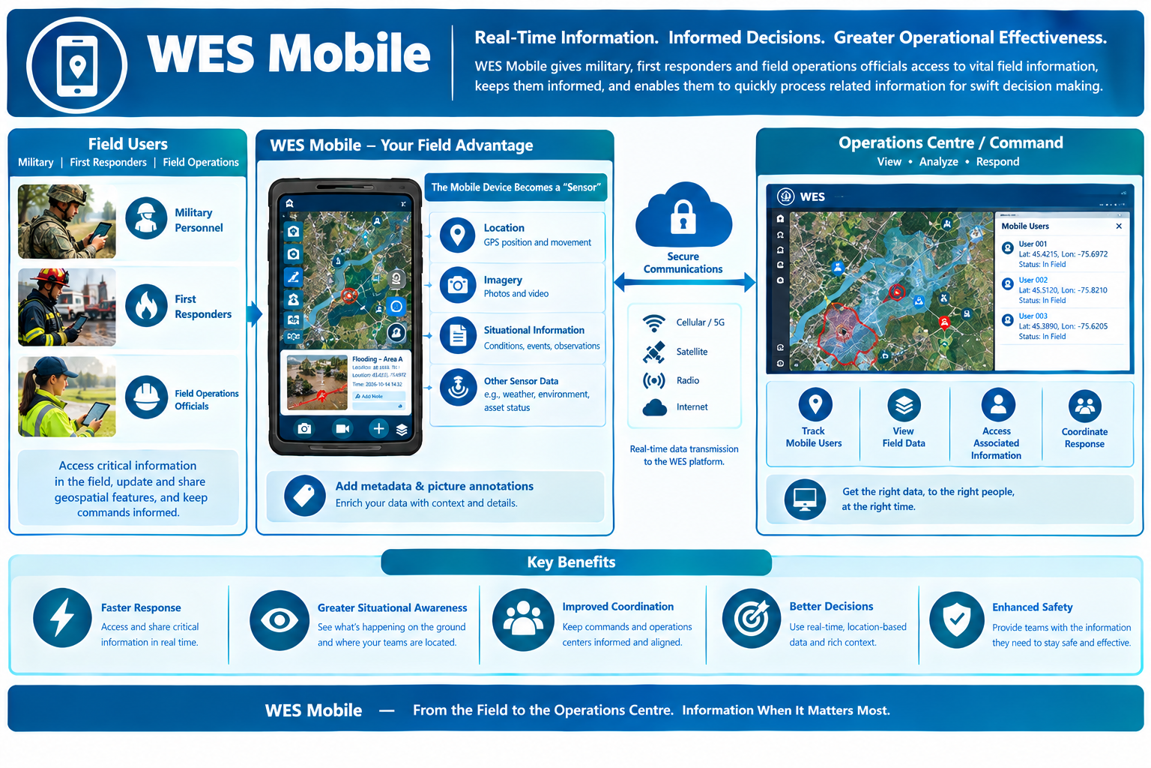
Mobile Access to Geospatial Products and Services
With WES Mobile, military, first responders and field operations officials are now equipped to access vital field information related to mission critical events, keeping them informed and providing them with the ability to quickly process related information for swift decision making. Users in the field can inform commands and operations centers by updating and transmitting geospatial features, including video and pictures that are augmented with metadata and picture annotations.
A mobile device can become a “sensor”, capturing and sharing data such as the device location, imagery, situational information such as conditions or events, and other sensor data.
WES Mobile also enables officials to use data transmitted from the device to determine where mobile users are and have access to critical information associated with the mobile user. This provides command operations personnel with quick access to data and allows them to use it efficiently for emerging situations.
WES Mobile and Wearable Device Interfaces
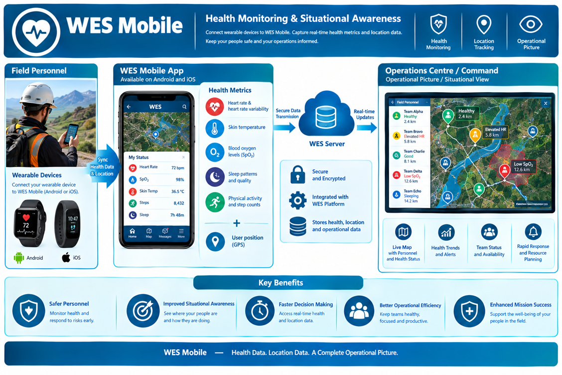
Users carrying WES Mobile that has been installed on either their Android or Apple device have the option of connecting wearable devices that monitor health related measurements. Typical health metrics monitored include:
- Heart rate and heart rate variability
- Skin temperature
- Blood oxygen levels (SpO2)
- Sleep patterns and quality
- Physical activity and step counts
This information along with the user’s position can be updated on the server so that an operational picture/situational view can illustrate not only where the field personnel are but also their health status
Request a Live Demo
Access our demo site to use a sandbox version of WES.


