GO Mobile Features/Benefits - Web Enterprise Suite

GO Mobile - Features
GO Mobile contains the following features:
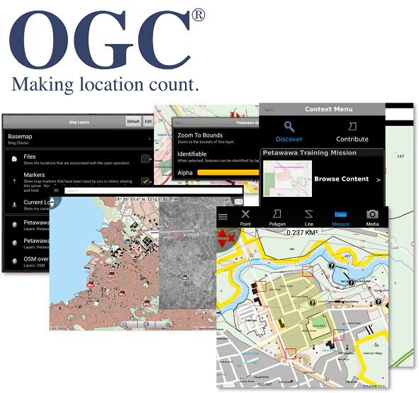
Enhanced Geospatial View. While in the Field.
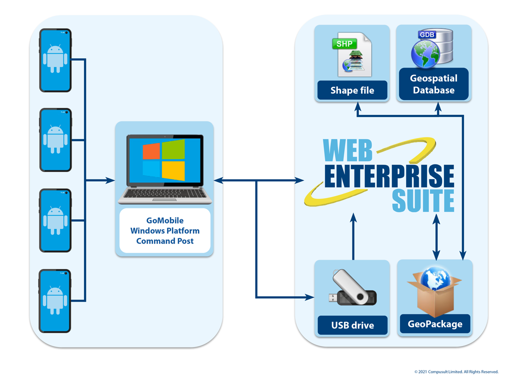
Prior to deployment to the field users can use Web Enterprise Suite (WES) to create geospatial packages (OGC GeoPackage) containing the necessary geospatial information and content to support field operations. In addition, if connected to a communications network, field users can perform real-time data discovery, access and download and conduct messaging among users. This provides superior geospatial/mapping awareness and enables the sharing of information and content among other mobile users. Users are provided with the ability to dynamically change the geospatial view to support multi missions/events/incidents and update these views in real-time.
Decision Support System. Prepare, Respond, Mitigate.
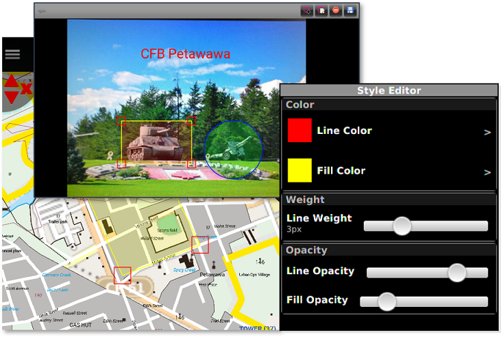
With GO Mobile, military, first responders and field operations officials are now equipped to access vital field information related to mission critical events, keeping them informed and providing them with the ability to quickly process related information for swift decision making. Users in the field can inform commands and operations centers by updating and transmitting geospatial features including video and pictures that are augmented with metadata and picture annotations.
Situational Awareness. Common Operating Pictures.
Encompassing several valuable features, it not only provides users with the option of sharing information with others through their mobile device of choice, but GO Mobile also enables officials to use data transmitted from the device to determine where mobile users are and have access to critical information associated with the mobile user. This provides command operations personnel with quick access to geospatial data and use it efficiently for emerging situations.
Supports Multiple Standards. OGC Complaint.
The Compusult GO Mobile app is a standards-based component of Web Enterprise Suite (WES) that supports OGC standards allowing the fusion of data from multiple sources into a single, integrated environment. Officials in industries such as Homeland Security can now effectively and efficiently have a consolidated view of all relevant geospatial data, regardless of the source, from their mobile devices.
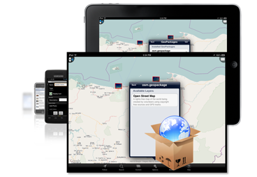
Disconnected Operations. Access to Data in the Field.
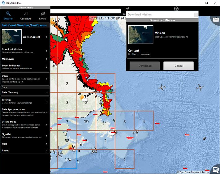
While using GO Mobile in the field, military and emergency response personnel can operate in a disconnected environment. Users can preload data and services for the area of interest for the operations using the GO Mobile GeoPackaging Service. The GeoPackage may contain base maps, overlays, and/or vector features and optionally encrypts them. Once loaded, the files remain encrypted, ensuring lost or stolen devices do not compromise secrecy and confidentiality. In the field, new data collected will be automatically updated and shared once the device is in range of connection services.
Manage Data More Effectively. For Public Safety.
Dealing with public safety issues requires accurate information, preparedness and effective management of data. With GO Mobile, an administrator can set up a dedicated portfolio and user group based on a particular incident, event or disaster, with the portfolio's Area of Interest (AOI) focused on the actual area of concern. Data can be stored within the portfolios, allowing users to manage and organize information for enhanced decision making. In addition, members are aware of other user's locations, can track historical events and can communicate through media sharing.
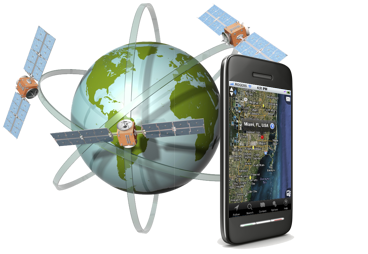
Sensor Observations.
For First Responders.
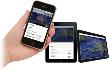
With GO Mobile, a user's Android, Windows-based smartphones, tablets and PCs can become a "sensor platform", capturing and sharing data such as the device location, pictures, videos, audio and other situational Internet of Things (IoT) information such as information from smart clothing with flexible sensors for cardiac, respiratory, etc. Emergency Response Officials can establish where other personnel are located and obtain detailed status, assisting in coordinating their efforts and better determining response times.
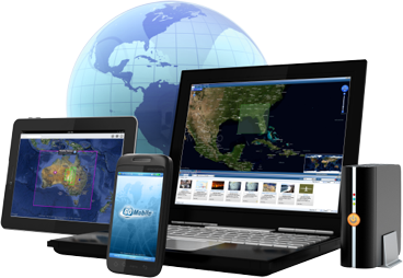
Combine with Web Enterprise Suite. See for yourself.
Using the Web Enterprise Suite Web browser interfaces users can visualize and combine GO Mobile information and content with other information and content from remote systems. In addition the Web Enterprise Suite component WES Desktop, providing ArcGIS Add-in modules for ArcMap and ArcGIS Pro enables users to visualize and analyze information and content using the ArcGIS tools.
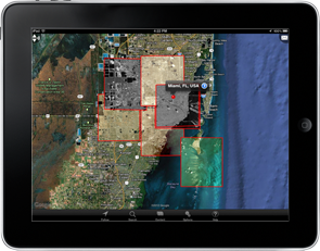
GeoPackaging. For Surveys, Missions, Incidents and Events.
Compusult is the leading vendor in generating geospatial data (GeoPackages) in support of providing supporting information for surveys, missions, incidents and events .
Our contributions/extensions to standard GeoPackages include: sophisticated styling rules for vector features, methods of precalculating and storing simplified versions of vector feature geometries at a variety of scales and a mechanism of storing dictionaries for feature attribute codes, allowing easier human interpretation of feature metadata and allowing dynamic feature metadata capture.
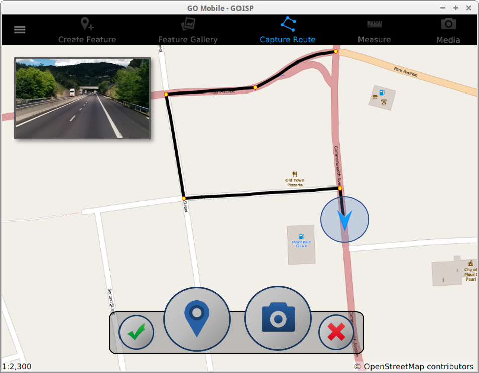
Route Capture. Enhanced Situational Awareness.
A unique feature of GO Mobile is its ability to conduct a route capture. Route captures can be used in support of situational scenarios in the event evacuations or access is required. It can also be used as a tool to provide video feeds with vectors illustrating the current situation. Software will insert route directions (e.g., TURN LEFT) into the navigation control points based on GPS tracking. After the route is completed, users can edit the route:
- Allow aligning the GPS captured routes to basemap data such as the road network.
- Add, remove, edit control points.
- Add, remove, update, reorder pictures on control points.
- Add, remove, update routing directions on control points.
GO Mobile - Benefits
GO Mobile benefits are as follows:
Situational Intelligence and Decision Support.
In support of situational intelligence and decision support GO Mobile:
- gathers situational intelligence in real-time;
- accesses portfolios for organizing and containing content for incidents, events and missions;
- enhances situational awareness by accessing geospatial data, sensor IoT devices for rapidly changing information and alerts in a real-time environment;
- provides overlay of information (weather, operational databases, other sensor data, etc.) to create common operating pictures; and,
- operates in a disconnected environment (Supporting GeoPackaging Services).
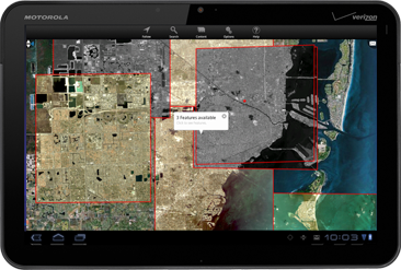
Discover and Access Data. See for yourself.
- Search, manage and discover geospatial data from disparate sources.
- Perform a geospatial search of the map area.
- Discover geographically relevant images, maps, reports and news.
- Navigate the map with touch to search an area, create an area of interest, create linkages and discover data for decision making.
- Track historical events.
- Track and locate like-authorities (Military Personnel, Police, Fire Fighters, Emergency Response).

Collaborate and Share. Content and Information.
- View other GO Mobile users on mapping applications provided using open standards such as Web Mapping Service (WMS) in a defined area of interest.
- Capture and store information (videos, pictures, documents, text) for sharing among members.
- Broadcast messages to other GO Mobile users with enhanced messaging capability.

Integrate and Sync Geospatial Databases. ArcGIS Database.
Combined with Web Enterprise Suite, GO Mobile can extract information and content from ArcGIS file geodatabases and store them in an OGC-complaint GeoPackage. The GeoPackage is then stored on the device for use in operations by field personnel.
In the field these personnel can now update and add new features metadata and attributes combined with media (video/photos/etc.) that are stored in the GeoPackage. This can be performed in disconnected and connected operations.
GO Mobile identifies what changes to features have been made and will synchronize these changes to the original file geodatabases on demand.