GO Mobile - GIS Mobile Software - WES

GO Mobile
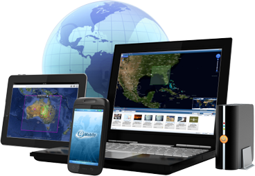
GO Mobile is a mobile app for iOS, Android and Windows-based smartphones, tablets and PCs that provides and supports superior situational awareness for military users, first responders and other field users that use and collect geospatial information in connected and disconnected modes of operation. It allows users to easily discover and access geospatial content and other data and services through a variety of communication networks. GO Mobile provides the collection, sharing and synchronization of information and content among other mobile users, command/operational posts and centralized operations, such as regional headquarters.
Mobile Access to
Geospatial Products and Services
Working in any industry in today's environment requires individuals to be on the move and have easy access to information related to work tasks. Industries such as Emergency Response and Public Safety are no exception, and personnel may typically need to use their mobile devices for retrieving geospatial data and services, even in disconnected environments.
GO Mobile is a mobile application for devices such as iOS, Android and Windows-based smartphones, tablets and PCs, that provide users with the ability to easily access products, information and content through WES. Encompassing several valuable features, it not only provides users with the option of sharing information with others through mobile devices, but GO Mobile also enables officials to use and obtain information collected in the field in near real-time for Situational Awareness and Common Operating Picture functions.
A mobile device can become a "sensor", capturing and sharing data such as the device location, imagery, situational information such as conditions or events, and other sensor data. GO Mobile is an added feature of WES, supporting organizations that require fast, secure, and reliable access to geospatial information for decision making purposes abroad.
GO Mobile supports industry standards, in particular those relating to the Open Geospatial Consortium (OGC) (i.e., GeoPackage, WMS, WMTS, SensorThings, etc.). It was a pioneer application that was used to test, verify and expand the GeoPackage OGC and related specifications.