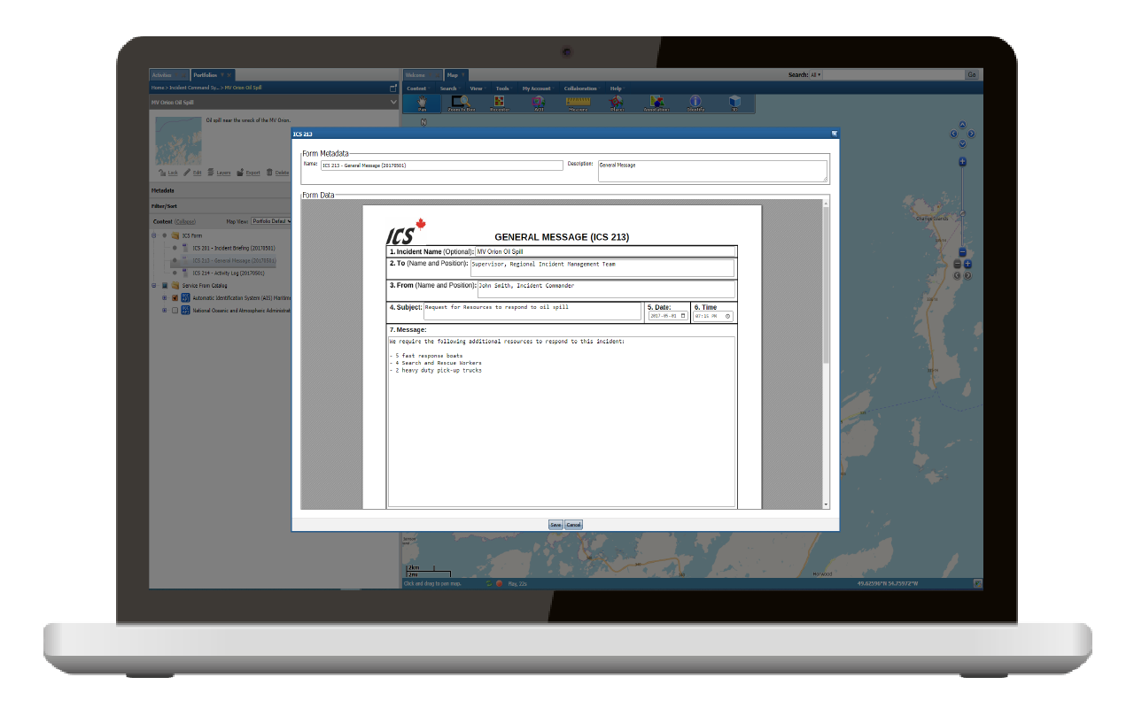
Web-based forms available in both English and French languages that enable easy data entry, exactly reflect the paper/Microsoft Word/Fillable PDF versions and are pre-populated with as much information as possible.
Interconnected PostgreSQL Database
An interconnected PostgreSQL relational database that stores all information entered into the forms for historical reporting and analysis.
Apache Superset Open-Source Application
Integration with the open-source Apache Superset application that contains predefined reports and dashboards for providing up-to-date status of incidents and events. Instructions are provided to enable users to generate custom reports as needed.
GO Mobile For WES ICS
GO Mobile is pre-configured to allow first responders in the field to capture relevant ICS information and content in the field in both connected and disconnected operations.
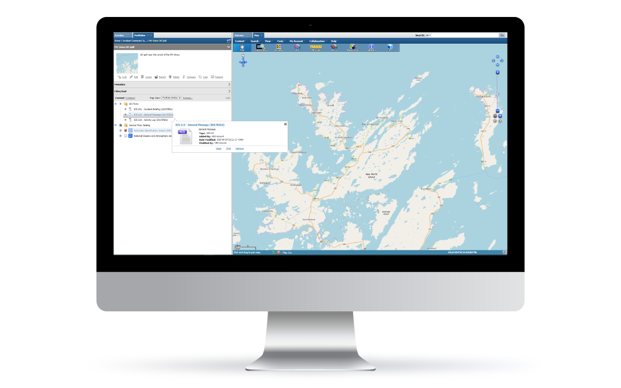
WES Portfolio is tightly integrated with WES ICS so that all information, be it GIS-related, data or data product-related is accessible in the same container.
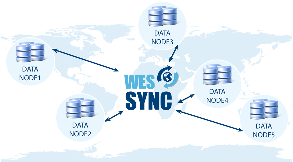
A replication service to allow for sharing content between installations of WES on separate hardware and/or networks in support of separate security domains, regional nodes or quality of service goals. It also supports synchronization of content and services between ArcGIS Enterprise installations.
WES Portal is a component of WES that provides organizations with the ability to collaborate and discuss situational awareness regarding any mission, event or incident an organization may be tracking.
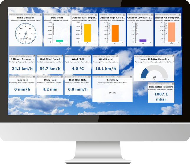
SensorHub is a companion product to Web Enterprise Suite (WES) that uses open standards to easily connect various sensors and devices, such as cameras, body worn sensors (ECG, EKG, EMG, etc.) and platforms such as weather stations and drone imagery, to a networked environment to enhance situational awareness and the overall decision-making process. It provides an open and unified way to interconnect the Internet of Things (IoT) devices, data, and applications over networks like the web that would otherwise be difficult to access and use.
An automated, easy-to-use publishing and discovery metadata management service for geospatial, structured and unstructured, data using OGC, ISO and other metadata standards. It allows users to create and search standardized metadata from database repositories or file-based data.
FasseTrack is fielded, Commercial Off-the-Shelf (COTS) software that provides comprehensive tracking of any number of different physical assets and other items with full barcode and RFID support.