
Emergency Management - Web Enterprise Suite
Emergency Management
Efficient decision making during high visibility or high stakes emergency operations.
Emergency Preparedness Is Critical
Disaster and Emergency management involve not only responding to disasters, but also preparing for them. Emergency preparedness ensures communities, cities and countries are ready if a disaster was to occur. Geospatial data is vital for numerous different areas, and disaster and emergency management is no different. Organizations and agencies require endless amounts of geospatial information to prepare for potential disasters, and to also formulate plans to quickly and efficiently deal with emergencies and their effects.
Having accessibility and the ability to manage geospatial data is crucial, therefore a solution such as Web Enterprise Suite is important for decision makers, and most importantly all those affected by various disasters. Please read more about WES and all of its features, critical in disaster and emergency response and management.

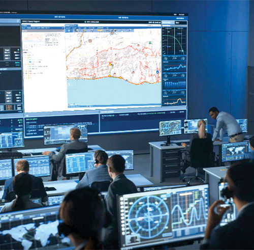
Who needs a Common Operating Picture?
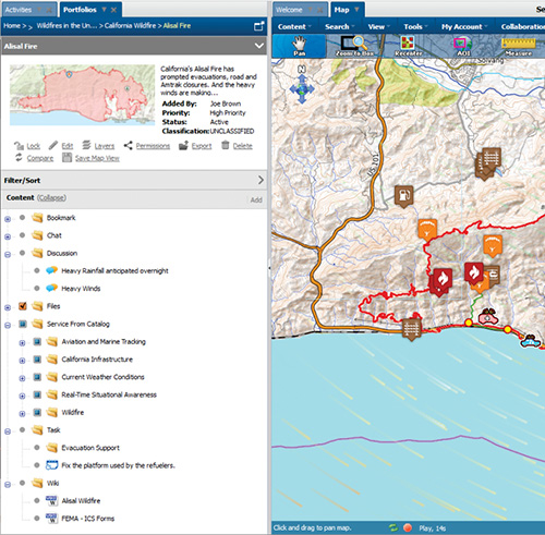
The Components of WES EMC
WES EMC combines GIS and sensors, collaboration tools, FasseTrack logistics software, and the GO Mobile application for a complete enterprise-level incident management package.
How WES EMC Works
WES EMC is powered by Compusult's WES software. It ingests and displays multiple sources and types of data from outside feeds as well as sensor data. It will help your organization operate, manage, and display:
- Geospatial information
- Collaboration tools
- Logistics
- Mobile applications input
- Other feeds like weather, temperature, and wind speeds
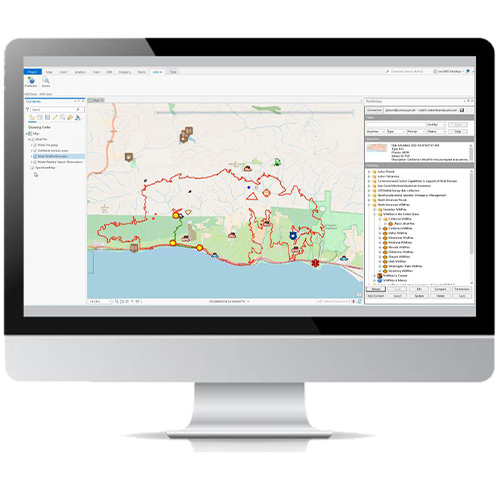
Utilizing the Power of WES Desktop
Other Features

Collaboration
WES EMC allows for social networking and collaboration. Users can share information, pose questions, solicit input, coordinate, and collaborate on a variety of issues.
Sensors
The SensorHub software integrates sensors throughout any area of interest and displays that sensor data for operational assessment, use, and information sharing.
Tasking
Tasking management allows assignment, notification, monitoring in real time, remote updating, and prioritization of tasks for operational control.
Asset Management
Compusult's asset management solution - FasseTrack - ensures the logistics functions supporting operations can provide:
- Asset management and tracking of an unlimited quantity
- Ordering and procurement flexibility
- Interaction with mobile devices for remote field support
Request a Live Demo
Access our demo site to use a sandbox version of WES.


